Sunday, April 29, 2007

Back in Annapolis


Photo: +Compass Rose" departing Solomons, MD


We made a 6.5 hr cruise up the Bay in calm seas fighting a 1/2 wind and tide driven current.


Photo: Almost home...passing the Thomas Point Light

Nevertheless, we arrived in Annapolis and picked up mooring ball #17. Awaiting us on the dock were Kim, Carson and Cameron. What a great welcoming party!

Saturday, April 28, 2007

The Chesapeake Bay

We left Portsmouth at 6:50a and headed through the Hampton Roads area. The Navy is well represented here! Two carriers were in the Portsmouth Naval Shipyard and two more were in their berths at the Norfolk Naval Station.
Photo: Canadian Frigate entering Hampton Roads
Compass Rose entered the waters of the Chesapeake Bay at 8:40a (where were the dolphins to greet us?!) Then we promptly entered a fog bank! With visibility down to nothing we continued on closely watching the radar and GPS. Despite NOAA's forecast of 2-3ft seas, the Bay was absolutley flat. We had a slight wind behind us plus a following current. So we decided to go for it and continue on to Solomons. At 4:35p we crossed back into Maryland. Nice to be back...we understand there is a new Governor since we left(?) After fourteen hours and twenty minutes we pulled into Calvert Marina in Solomons, MD. The owner, Matt Gambrills was even there to help us with our lines. We had covered 99 nm and it was a very easy cruise with Otto doing most of the work. Let's see what the weather has in store tomorrow...

Norfolk/Portsmouth, VA

The following day, the four boats left the Visitors Center and continued north to make the 11:30a locking at Deep Creek. Robert, the Lockmaster there, is someone who really loves his job. Pam gave him a small conch shell she found in the Bahamas to add to his collection.

Coming out the the Dismal Swamp canal and entering the Norfolk area is like a slap in the face. After two days of tranquil waters and scenery, one is greeted with enormous ships, cranes, drydocks, tugboats and noise! Guess we're not in Kansas, Toto!

"Compass Rose, "Morning Star" & "Symmetry" all pulled into the free docking basin in Portsmouth, VA. Pam and John walked around town visiting antiques shops and generall exploring the renovated 'olde towne' area.
Photo: Compass Rose in Portsmouth, VA (USS Iwo Jima in the background)

The NOAA weather forecast is calling for increasing winds Sunday and Monday with corresponding seas; so, the plan is to leave here early tomorrow and get as far north as we can.

Friday, April 27, 2007

Dismal Swamp

When we last left you, we were in Elizabeth City, NC. A group of locals known as the "Rose Buds" holds a welcoming reception on the waterfront anytime there are five or more boats there. This time of year that is most every day. Fred (age 94) is the 'ringleader' and he makes everyone feel very welcome.

We planned to depart Elizabeth City at 8:30am when the drawbridge opens. This would allow us to make both of the locks on the Dismal Swamp in one day. "Morning Star" (Randy and Cindy Pickleman), "Symmetry" (Tom & Lisa), "Esprit" (Art & Barb Dister) and "Compass Rose" were lined up to go through the bridge when the bridge tender informed us that one of the gates across the road would not go down. This interrupted the bridge lifting sequence and he could not raise it.

After milling around for thirty minutes, they finally got it fixed and we went through at 9am. The delay meant that we would have to make 9kts SOG to make the South Mills Lock at 11:30a. No way to do that in the serpentine Pasquotank River. So we all agreed to slow down and makie the 1:30p locking. Of course, that would mean we would not make the last locking of the day at the Deep Creek Lock.

After locking through at South Mills we continued on a few miles and stopped at the free docks at the North Carolina Visitors Center. All eight of us enjoyed a wonderful potluck dinner hosted by Cindy & Randy onboard "Morning Star".

Travelling through the Dismal Swamp is a not-to-be-missed experience. Considering that it was originally surveyed by George Washington, it is a step back in time. A very peaceful and relaxing journey...


Photo: "Symmetry" in the Dismal Swamp"


Photo: Locking through at Deep Creek

Photo: Crossing into Virginia


Photo: Pam at the North Carolina Visitors Center


Thursday, April 26, 2007

Cruising Through North Carolina

After leaving Myrtle Beach we crossed into North Carolina, a state with great waterways. We would spend the next six days making our way through the Tar Heel state.

We anchored in Wrightsville Beach with Martin and Betsy on Saturday. Went into town and ate Mexican food. They treated us to a fabulous breakfast of waffles and sausage Sunday morning.

Two days later we were in Oriental, NC after anchoring off Swansboro the night before. We had dinner with Steve and Mary Jane Floyd ("Cygnet") whom we had met in Spanish Wells, Eleuthera. Dined at the Oriental Steamer restaurant.
Photo: John, Pam, Mary Jane & Steve


Photo: John celebrating his birthday underway with an oreo cookie 'cake'.

Tuesday found us anchored in the Alligator River after of ten hour run. There is a military bombing range close by and we were "strafed" by a pair of Marine F-18's as we made our way north.

Photo: Passing a tug and barge on the Alligator River

Photo: F-18 Making a run on us.


We arrived at Elizabeth City, NC Wednesday afternoon and got a slip at their free city dock. For dinner, six of us went to the Carolina Theater; this is a dinner theater with a very extensive menu. Saw "Fracture" with Anthony Hopkins. Great way to watch a movie.

As we arrived in Elizabeth City, the engine hour meter clicked over to 6,000 hours. Still being broken in...

Sunday, April 22, 2007

Myrtle Beach, SC

We stopped at Myrtle Beach for two days (and we don't even have our golf clubs!). The Barefoot Landing docks are right at the Barefoot Landing Outlet Center. Martin and Betsy Basch ("Molly Blossom") joined us on the second day. We stopped by The Fudgery where this fifteen year old kid did an amazing "presentation" of fudge making and fudge selling.


Photo: The Little Hustler


Photo: A factory outlet for Bibles??! Who knew?!


Photo: Betsy, Martin, Pam & John at "Maggie Moos"


As soon as you leave Myrtle Beach northbound, you enter "The Rock Pile". This is a cut on the ICW which was dynamited through the rocks. At low tide, the sharp rocks are very visible along the sides. Low tide shows the rocks clearly while high tide provides an extra three feet of water by also hide the menacing rocks. Your choice...
Photo: Starting through the "Rock Pile" in the early morning mist.

Saturday, April 21, 2007

Brookgreen Gardens


While in Myrtle Beach, SC we rented a car and drove down to Murrell's Inlet to visit Brookgreen Gardens.


In 1931, Archer and Anna Hyatt Huntington founded Brookgreen Gardens to preserve the native flora and fauna and display objects of art within that natural setting. Today, Brookgreen Gardens is a National Historic Landmark with one of the most significant collections of figurative sculpture in an outdoor setting by American artists in the world and has the only zoo accredited by the American Zoo and Aquarium Association on the coast of the Carolinas.

Although the recent cold weather brought a premature end to the displays of flowers and fauna, the 550 sculptures that were on display throughout the 50 acre gardens were breathtaking. Overall, the entire preserve covers 10,000 acres.


This is a photographers paradise! Below are just a few of the many photos we took of this amazing and inspiring place.


Tuesday, April 17, 2007

The South Carolina Low Country


We were finally able to leave Beaufort, SC once the weather passed. Cruising through the low country of South Carolina is like no other place on the waterway. First of all, the tides are 6-7 ft so the docks behind the houses are almost 1/4 mi. long just to get to deep enough water. The tides completely change the way the land appears...an expanse of sea grass covers the area at high tide while low tide exposes many hidden islands and oyster mounds.


We continued past Charleston and anchored in a very secluded creek. Just us and the stars...


Photo: Charleston, SC waterfront


Tomorrow is a new moon so the low tides have been over a foot lower than normal. We heard numerous calls to "Tow Boat" from boaters aground today. The photo shows a large motor yacht high and dry along the ICW. High tide will bring the water level up 6' so he can float off.


Photo: High and dry

Photo: Sunset over the marshes from tonight's anchorage

Sunday, April 15, 2007

Beaufort, SC


Photo: Beaufort, SC waterfront park


It's Sunday and we are still in Beaufort. This is a very nice little town so we decided to spend a few extra days here. But the massive cold front that had pounded the entire east coast has kept us here an extra day (or two). We wisely left the anchorage yesterday morning and got into Beaufort Downtown Marina before the weather hit. Luckily, we are on an 'inside' slip protected from the waves. Winds have been in the 30-35 kt range with gusts in the 40's.


Beaufort, like its 'cousin' city in NC, was named in 1709 after Henry Somerset, the second Duke of Beaufort. The waterfront renovation is now completed and the park is beautiful. The many houses from the 1700's and Civil War area have made this a popular place to film movies. "The Big Chill", "The Great Santini", "Forrest Gump" and "The Prince of Tides" were all filmed here.


Photo: Sculpture in town


Photos: "Mermaids" About Town

Thursday, April 12, 2007

Onward to South Carolina

Anchored in Turner Creek just south of Savannah. We ran into another Krogen we had never seen before. Bob and Dora Turner on "Seascape" from Vero Beach have owned this 1980 Krogen (#18) for 20 years. They both recently retired and are heading for the Chesapeake and will continue on doing the "Loop".

Both of us left at 6:46am to ensure we had enough water in the shallow spots. Good thing too! Several places we saw 5 ft of water and the tide was still 4ft up.

With such an early start, we ended up anchoring off Beaufort, SC at 12:45pm. This one is pronounced "Byew-furt". The one in North Carolina is "Bo-furt". They are both named after the same person so, go figure.

Wednesday, April 11, 2007

St Catherine's Island, Georgia


We anchored for the night in Walburg Creek, a place we have stopped three times before. Went ashore in the morning for a walk at low tide. Observant 'bloggers' will remember the photos of the beach and trees from the last two years. The "tree graveyard" is a result of the salt water encroaching on the land killing the pine trees. Slowly, land is washed away from the roots and the tree finally topples. Not sure how long this process takes but there are some very dead, tall trees still standing with their roots exposed.


Tuesday, April 10, 2007

Baby, It's Cold Outside!!


It has been unseasonably cold here for Easter. Mid 40's at night. Not to worry, we just fired up the propane heater and put another log on the fire.Photo: "Fire" DVD on our TV

Monday, April 09, 2007

The Sea Isles of Georgia


Our first stop in Georgia was Jekyll Island on Easter Sunday. Most of it was closed up tight for the day. There is a lot of history asscociated with the area...the Rockefellers, Goodyears, Astors,Vanderbilts, Morgans, and Pulitzers used to gather on Jekyll Island for winter retreats. By WW II, the membership of the Jekyll Club controlled one-sixth of the world's wealth. Photo: Entering Brunswick, GA under the Sidney Lanier Bridge


Jekyll, St Simons and Sea Island are small 'sea islands' along the coast which have been developed with resorts.

Tonight we are in Brunswick, GA just 7 mi north of Jekyll. They 'only' have five flags here! The city was layed out by Gen James Oglethorpe in the same grid-manner of his other city, Savannah. There are a wide variety of antique shops, art galleries and restaurants located in old, renovated buildings downtown. Brunswick is also the self-proclaimed "shrimp capital of the world".


Brunswick Landing Marina is the only game in town. There is no anchoring anywhere. However, the marina is very nice with floating docks in a well protected site. Dockmaster Sherry is very informative and makes you feel very welcome. Photo: Shrimp fleet in port Brunswick


Photo: Oak tree in Brunswick rumored to be 900 years old.


Photo: Pam standing next to a steam powered thingamachig with cable

Sunday, April 08, 2007

Cumberland Island, GA

GEORGIA-FLORIDA LINE

We crossed the FL-GA border this morning. An imaginary line of language separates Georgia from Florida. North of the border are English names like Kings Bay, Dungeness, Stafford and Cumberland. South of this border the Spanish names begin: Fernandina, Vilano, Ponte Vedra, and Matanzas.

THE HORSE LATITUDES

It’s hard to imagine making a trans-Atlantic crossing on a heavy wooden sailing ship with enough provisions for crew and farm animals. At best, the ships traveled at four to eight knots. But when they hit the mid-latitudes, between 30 to 35 degrees north and 30 to 35 degrees south, headway was even slower.

The mid-latitudes were notorious for their weak winds. It could take weeks for a sailing ship to pass through these areas, hence named “horse latitudes” because the horses were often the first casualties. Although historical accounts differ, the both speed up the conserve precious food, the horses were either thrown overboard or eaten.

And now you know the “rest of the story”!

Fernandina, FL

Fernandina Beach, FL

We did not stop at this city on the way north this year but loyal blog readers will remember our last two visits (who can forget the “Marvel Mystery Oil” in the water tank incident?!).


In the early 1800’s, Fernandina was a border town and became one of the most coveted pieces of land in North America. Being the closest port outside U.S. import regulations, it attracted shippers, pirates, slavery and British spies.

While many cities (and amusement parks) claim “5 Flags” or “6 Flags”, Fernandina has had eight flags flown over the city:

Conquistadors
French Huguenots
Spain
England
Mexico
Republic of Florida
Confederate
United States


And, that's your history lesson for today!

Saturday, April 07, 2007

Headed North On the ICW

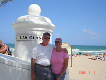
After two days in Vero Beach restocking up on food stuff, night out at the movies and of course a run to West Marine, we started north up the Intracoastal Waterway. A couple of thirty mile days put us in Melbourne and then Titusville. Two sixty mile days got us to Palm Coast and now we are anchored in St. George just north of Jacksonville, FL.

While in Melbourne, we met up with Greg and Susan Han (Allegria) and joined them for "Boaters' Night" at the Eau Gallie Yacht Club. They are members of the Key Biscayne Y.C. and were invited as guests. That would make us guests of guests! EGYC was formed in 1907 which makes this their Centennial year.

We also made a two hour stop in Cocoa, FL just to check it out and stretch our legs. The downtown has many neat shops and restaurants and a wonderful waterfront park. Glad we stopped.

There isn't anywhere in Florida we want to see again just yet. Savannah, Beaufort and Charleston beckon next week...

Happy Easter to everyone!

PS: Haverford 11 Boys Latin 10 (ot) Score one for the Philly boys!

PPS: Had a little 'scare' today when the engine quit...we were transferring fuel to balance the boat and forgot to turn it off. For reasons yet unknown, this caused fuel starvation. After quickly dropping the anchor in the middle of the ICW, John 'bled' the engine and pumped fule back in the filters. Thankfully, the engine started before we got run over!

Wednesday, April 04, 2007

Back in the U.S. of A.

Well, the plan worked! We headed northwest and bumped into the state of Florida! That was easy.

We departed West End, Bahamas at 0615 (dark!) and headed towards Ft Pierce, FL. With the Gulf Stream current running north at 3-5 knots, we took a 15 degree cut to the south. Ten hours later, we entered the inlet at Ft Pierce having averaged 8.2 knots for the 82 nm run. The inlet was pretty 'sporty' with the outgoing tide running into the SE winds. All in all, a pleasant crossing. Both the wind and waves were mostly behind us. Once in the inlet we continued up the ICW for another two hours and finally stopped in Vero Beach.

The next day we rented a car and drove to the Ft Pierce airport to clear customs and immigration (which took all of 3 minutes).

We have no pictures of the crossing since it was all water and sky! Unlike the crossing over to the Bahamas in February, we could see land (or at least condos) fifteen miles out. GPS makes the navigation so much easier and takes away a lot of the anxiety.

Tuesday, April 03, 2007

West End, Bahamas


West End is the one of the 'jumping off' points in the Bahamas for the crossing back to the states. We anchored off and took the dinghy in to Bahama Bay Marina where Suite Luxury and La Garza Verde were docked. We had one final dinner (last supper?!) before crossing the Gulf Stream the next day. Photo: Last night in the Bahamas (Bob, Jane, John, Pam, John, Susan)


Our plan was to leave early Monday morning and head northwest to Ft Pierce.

Monday, April 02, 2007

Great Sale Cay


We continued west on the Bahama Banks to Great Sale Cay. This is basically an uninhabited island (one of many!) which is a good anchorage to spend the night. There were over 25 boats there this evening.


We got together on "La Garza Verde" (John & Susan Hauge) with Jane and Bob ("Suite Luxury") for Happy Hour and an unbelievable sunset. Photo: Suite Luxury on the Bahama Banks.